The movement downward is not merely concealment, but a reorganisation of space forced by a mode of war that seeks to make the visible world fully vulnerable to interruption.
The conflict in the Gulf, now under a fragile two-week ceasefire after 42 days of intense fighting, is not just being shaped by missiles, bombs, and interception systems alone. It is also reshaping the battleground itself.
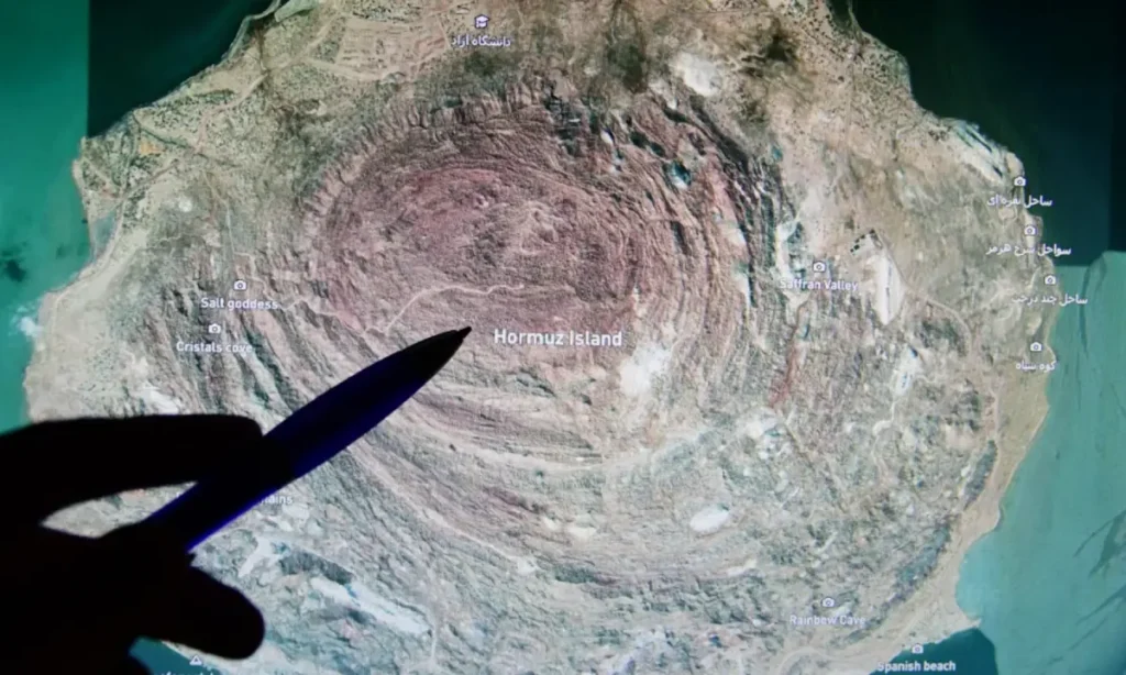
This is starkly visible at Iran’s Qeshm Island.
Beneath the island’s coastal settlements, desalination systems, and free trade infrastructure runs a buried military architecture that binds geology, logistics, and strategic force into a single terrain.
Coincidentally (or not), Qeshm Island sits within the same geography that shapes global fuel prices, shipping costs, remittance economies, and the broader political risks across the Arabian Sea: the Strait of Hormuz.
And this geography becomes harder to grasp if the war is read only through an airstrike, a missile interception, or the latest diplomatic development, because the conflict is also reshaping the material ground on which circulation depends.
On March 7, just a week into the war, Iranian Foreign Minister Seyed Abbas Araghchi claimed that the United States had struck a freshwater desalination plant on the Qeshm Island. The strike, which Tehran termed a “flagrant crime” against civilians, cut off freshwater supplies to 30 surrounding villages.
The attack exposed something larger: water systems, shipping routes, and the management of the world’s most vital energy corridors have been folded into the same field of conflict. War is no longer confined to distinct military sites; it unfolds across the systems that sustain everyday life.
The reorganisation of space
Once the surface becomes permanently targetable, the central problem is no longer simply survival under bombardment but the reorganisation of movement, storage, communication, and production within an exposed battlespace.
The visible layer of roads, ports, power systems, wells, workshops, and storage depots is drawn into an architecture of surveillance and attack that treats the built environment as a field of interruption.
Qeshm is not an exception. The tunnel in Gaza, the dispersed launch systems in southern Lebanon, and Iran’s Fordow nuclear facility, buried 80 meters of rock, do not appear as secondary tactics attached to a war. They are material arrangements produced under siege, sanctions, and continuous aerial threat.
Instead, they assemble routes, stockpiles, command structures, protected passageways, and hidden sites of repair into a form capable of sustaining political and military life under conditions in which the surface has been transformed into a zone of exposure and destruction.
The movement downward is therefore not merely concealment, but a reorganisation of space forced by a mode of war that seeks to make the visible world fully vulnerable to interruption.
Buried geography
The issue is not just limited to hidden facilities, but strategic capacity has been organised through hardened terrain, buried storage, and launch systems dispersed in ways that make it harder for strikes to produce the required results.
The significance of this architecture lies in the burden it places on the attacker, who must wage a prolonged war against tunnels, shielded routes, and layered sites of movement rather than merely targeting a finite list of surface-level installations. Damage in one location does not automatically disrupt the wider network of storage, transport and deployment.
Even from the air, the landscape appears as a field of coordinates and suspected activity nodes. But on the ground, it functions as a layered structure in which geology itself becomes part of the military problem, frustrating the conversion of aerial supremacy into total control.
This buried geography cannot be separated from the wider organisation of circulation, because the war is also a struggle over shipping routes, energy flows, sanctions, finance, and the supply chains that reproduce military force. Control over the skies is inseparable from control over maritime corridors, insurance regimes, energy transit, ports, and the industrial channels through which military capacity is sustained over time.
The Strait of Hormuz is not simply a route through which oil tankers pass, but a central artery in a global system that the United States and its allies seek to secure through naval deployment, missile defence systems, logistical agreements, and regional military integration. Iran’s buried infrastructure along this corridor matters because it allows the threat of disruption to be projected outward from beneath terrain that cannot be easily neutralised from the air.
At the same time, sanctions move through the same field by restricting banking access, insurance, industrial procurement, software, components, and machinery, attempting to degrade military capacity not only through bombardment but the slow severing of the circuits that make repair, transport, storage, and replenishment possible.
War, in this sense, extends far beyond the battlefield. It runs through ports, shipments, workshops and supply chains. To see it only as a sequence of strikes is to miss the larger struggle over how movement itself is organised and controlled.
More than a protective shell
Under these conditions, domestic production, dispersed workshops, and local engineering become practical responses to a form of war that combines bombardment with economic strangulation.
Their significance lies not in slogans of self-reliance but in the rebuilding of capacity under pressure, where production is reorganised across multiple sites, storage is buried and scattered, and movement takes place through concealed routes rather than exposed supply lines.
The attempt to reduce missile capacity through sanctions and strikes together becomes harder to realise once the relation between destruction and exhaustion is no longer direct. The underground, therefore, is not just a protective shell. Instead, it functions as a space where continuity (of survival, production, repair, and coordination) is maintained despite disruptions.
The buried route, the hardened chamber, the shielded workshop, and the dispersed cache belong to the same field of struggle in which the effort to preserve military continuity cannot be separated from the effort to preserve the material conditions.
The struggle, hence, is not only over missiles or territory, but over the organisation of space. Domination from above depends on rendering the ground fully legible, fully exposed, and fully available to interruption.
War unfolds not only through visible moments of destruction, but through the continuous remaking of terrain by those forced to keep movement, storage, production, and retaliation alive within a landscape subjected to repeated attack, blockade, and infrastructural attrition.
In this sense, the ground is not simply where force lands, but where bombardment is absorbed, rerouted, and worked against through buried systems that refuse to let the visible surface coincide entirely with the real terrain of war.
As long as this buried terrain continues to sustain capacity beneath the violence from above, Iran will likely continue to thwart the US-Israeli design to reconfigure the regional order through sheer ingenuity and defiance.
Header image: A satellite view of shipping traffic in and around the Strait of Hormuz on 24 March 2026. — Reuters