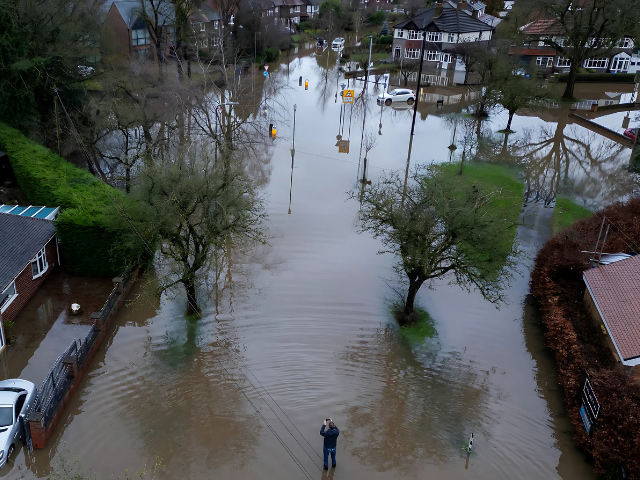
The UK is under a series of weather warnings as temperatures drop following significant flooding, with an ice warning in place for much of the country.
The Met Office issued a yellow warning for ice across Scotland, Northern Ireland, and parts of Wales, extending down to the Midlands, effective until 10 AM Thursday.
Additionally, northern Scotland is under a snow and ice warning, with travel disruptions anticipated due to rain turning to snow.
The Met Office and National Rail have urged travelers to plan ahead, advising drivers to expect difficult conditions, especially in areas under yellow weather warnings.
Passengers using public transport are also advised to check timetables for possible delays or cancellations, as poor weather is expected to impact train services across Great Britain, including those run by Northern, TransPennine Express, Transport for Wales, and ScotRail.
In addition to the warnings for ice and snow, two flood alerts were issued early Thursday morning for the Lower River Wharfe and Lower River Ure systems in North Yorkshire.
These areas, along with surrounding tributaries, remain at risk of flooding. The affected areas in the Lower River Ure system include low-lying land and roads around Masham, Boroughbridge, Aldborough, and Bishop Monkton. For the Lower River Wharfe, flood risks span from Otley to upstream of Ulleskelf, including Tadcaster.
Photo: Reuters
However, the Met Office expects water levels to begin receding shortly, with no further significant rainfall forecast for Thursday.
Travelers and local residents are advised to avoid low-lying footpaths and bridges near watercourses and refrain from attempting to walk, drive, or cycle through floodwaters.
The ongoing severe weather follows a major flooding incident in Greater Manchester, which led to the declaration of a major incident on Wednesday. Homes were evacuated, and roads and train lines were closed after heavy rainfall caused widespread flooding.
Greater Manchester police reported that the floodwaters affected areas including Didsbury, Stockport, Trafford, and Wigan. Approximately 450 people were evacuated from a hotel in Didsbury, while 400 other homes were deemed at lower risk and did not require widespread evacuation.
Rescue teams, including mountain rescue units, were deployed to assist the fire and rescue service with evacuating residents and helping those trapped by flooded roads. A block of flats in Stockport was also evacuated due to flooding.
In response to the extreme weather, the city of Bristol has activated its severe weather emergency protocol through 8 January. This includes increased outreach shifts and additional accommodation to ensure no one has to sleep on the streets during the ongoing conditions.
The heavy rainfall also caused extreme water levels, with Marsden recording 101.2mm of rain, more than West Yorkshire’s typical monthly rainfall, and Capel Curig in Wales also reporting 101.2mm.
The situation is expected to worsen with the onset of more snow and ice.
Looking ahead, a three-day yellow warning for snow has been issued for nearly all of England, Wales, and parts of Scotland this weekend, from noon on Saturday until 9 AM Monday.
Rural communities could be cut off, and schools may close. Power outages, road closures, and delays to flights and trains are also possible. The Met Office forecasts up to 5cm of snow in most affected areas, with as much as 20-30cm expected over high ground in Wales and the Pennines.
With further disruptions expected, both authorities and local residents are urged to stay informed and take precautions in the coming days.


